Drop in a question of your very own BY CLICKING HERE or by emailing Kathy Reiser at mailbag@news-gazette.com.
Follow-up questions on the Prospect Avenue reconfiguration project and Unit 4’s use of grant funds to curb gun violence … why most of Hessel Park’s lighting is on the east side of the park … and whether a crosswalk could be added to a busy road in west Champaign. All in this week’s Mailbag.
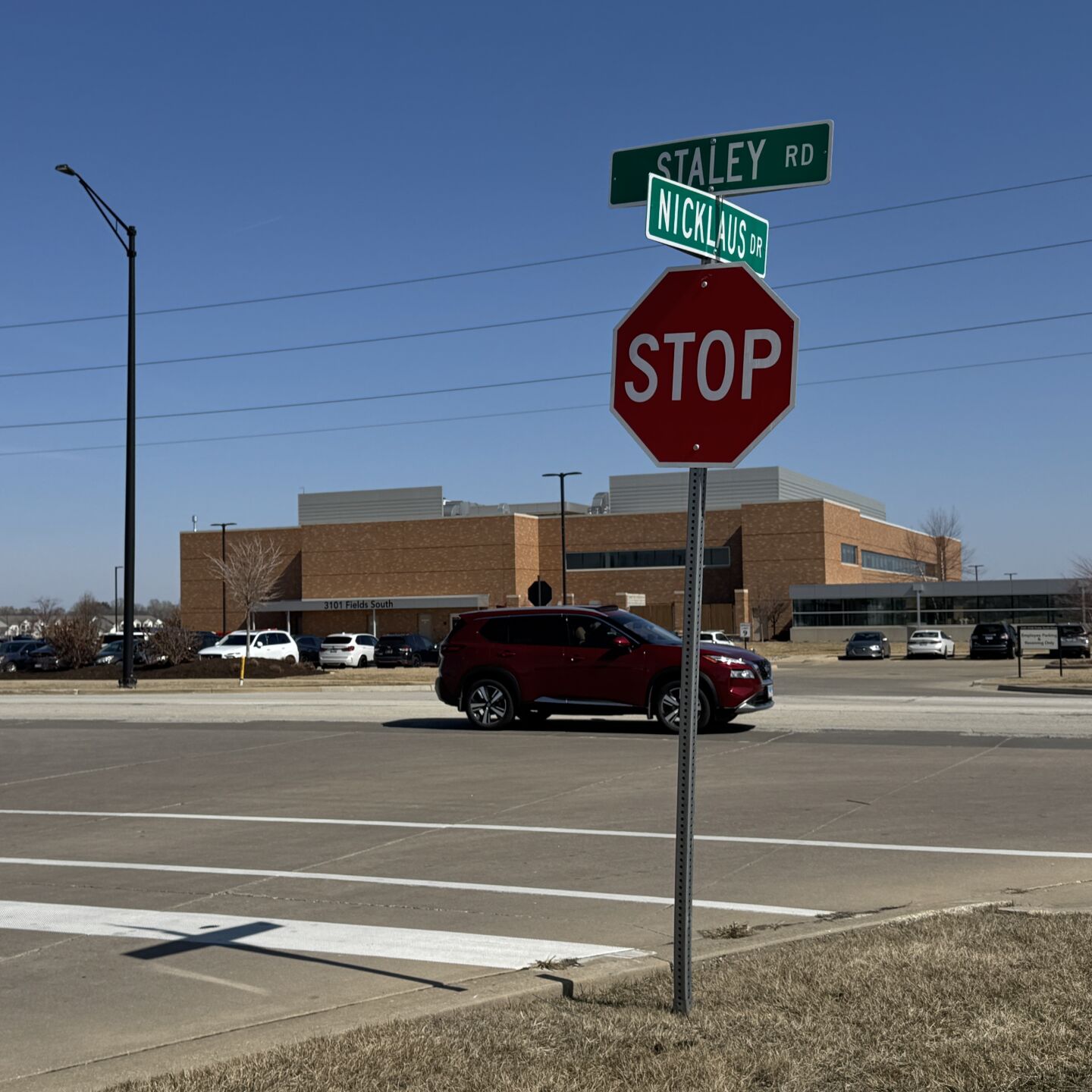
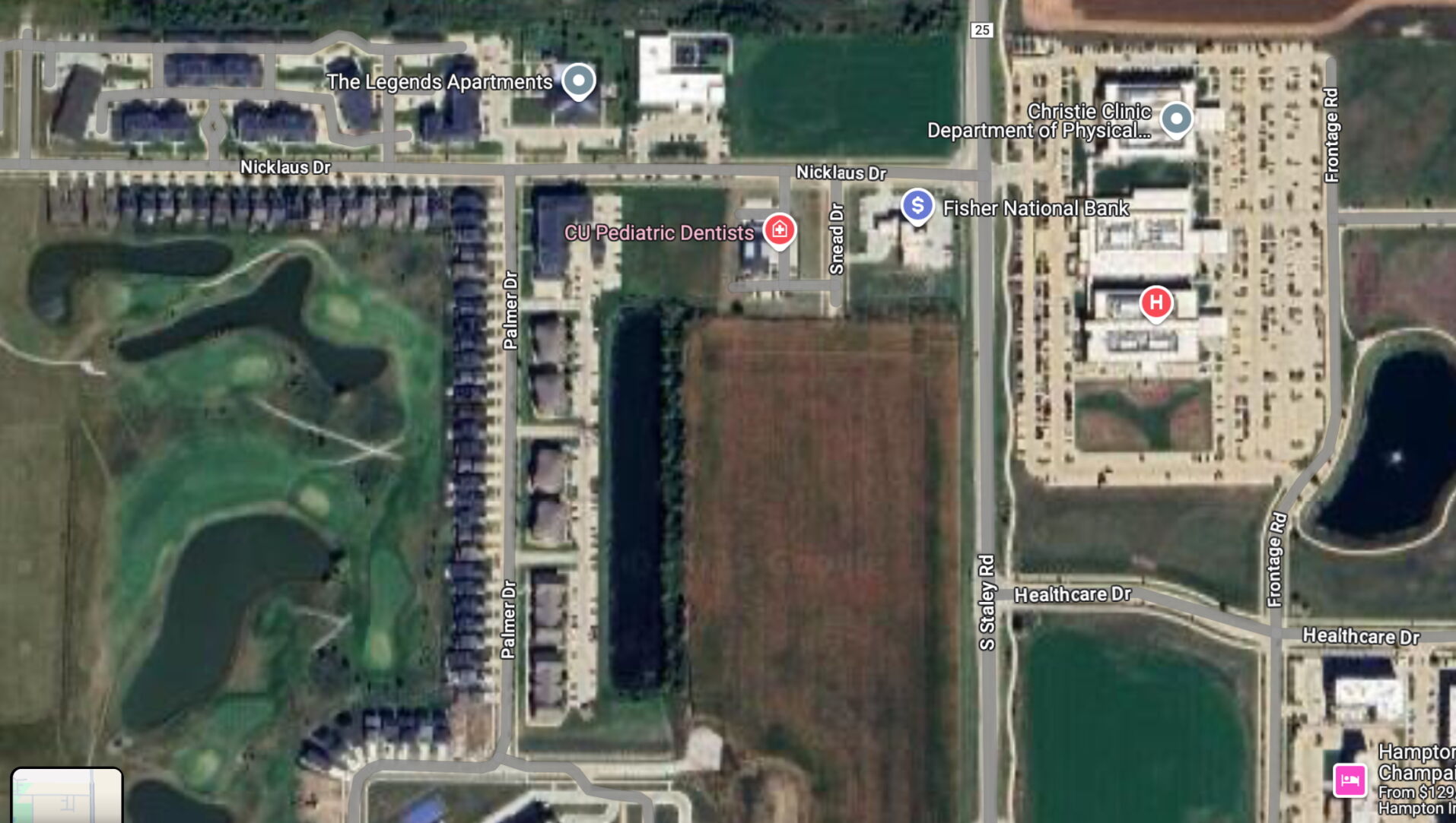
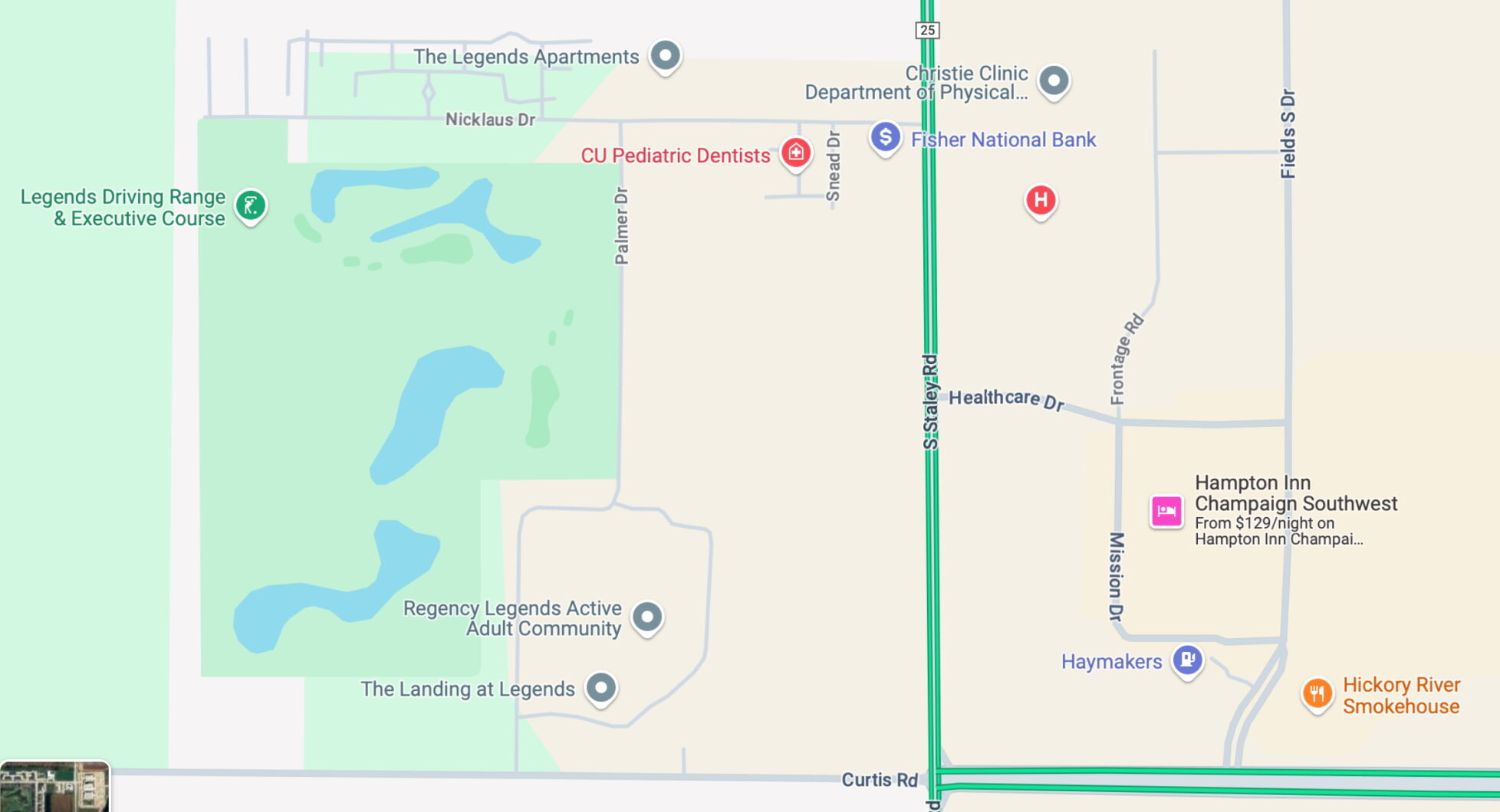
“There are many houses, businesses and apartments on Nicklaus Drive in Champaign. Crossing Staley Road to use the walking paths and trails in The Fields, is dangerous. Can we get a crosswalk so pedestrians can safely cross?”
It seems unlikely, at least in the near future.
The trail network on the east and west sides of Staley Road connects along the north side of Curtis Road via crosswalk at the all-way stop. The trail west of Staley connects north/south at Palmer Drive, according to Champaign Public Works spokesperson Kris Koester.
If a marked pedestrian crossing at Staley and Nicklaus is deemed appropriate at some point, he says the city would need to conduct an evaluation using the crosswalk guidelines adopted by the Champaign Urbana Urbanized Area Transportation Study (CUUATS) to determine next steps.
“This may indicate more than just a marked crosswalk and pedestrian signage – for example, flashing beacons,” Koester said. “The installation would also require installing ADA-compliant sidewalk ramps, and connecting the sidewalk on the east side to the path.
“Ideally, people would be able to walk down to Healthcare Drive, which may occur someday if the open field develops, as it would require a sidewalk construction along the west side of Staley Road. Crossing there would be the safest and best place for people to cross Staley, given the vehicle speeds in that area.”
He said funding for any of these improvements would need to be identified in the city’s capital improvements plan. And that could take a while.
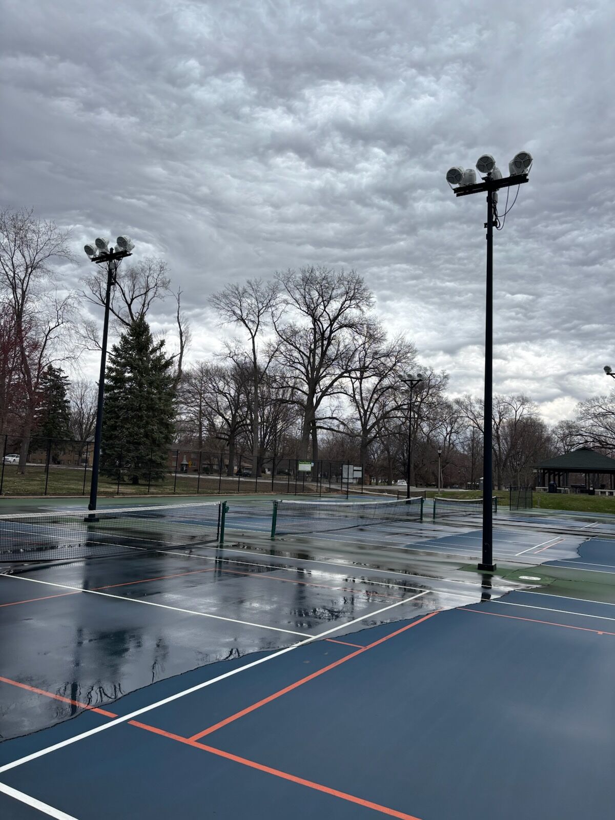
“I drive by Hessel Park before dawn every morning and notice that the west side of the park is dark while the east side is well lit. The division is right down the middle of the park, north to south. Is this in consideration of those who live on the ‘wealthier’ side of the park?”
Sarah Sandquist, the Champaign Park District’s executive director, came to CPD in late 2022. She checked into the history of Hessel Park’s lighting systems and found that the 25 lightpole fixtures in the park were installed more than 50 years ago.
“Their locations have not changed since then, with the exception of two that were relocated slightly to accommodate last year’s ADA parking-lot improvement project. All 25 fixtures are on the same electrical circuit, automatically timed to turn them all on at dusk and all off at dawn. The timer is battery-powered and makes adjustments throughout the year as daylight changes.”
Following the 1973 installation of the lightpoles, dedicated lighting for the tennis courts at the northwest corner of the park also was set in place. Sandquist said tennis players can turn on the timed court lights as needed, but the timed lights’ availability automatically cuts off at 11 p.m. when the park closes. In 2016, the older lightpole fixtures were retrofitted with energy-efficient LEDs, and all remain on the same circuit with the automatic dusk-to-dawn timer.
About 20 years ago, the park’s current perimeter pathway was installed, “which dramatically opened and increased Hessel Park’s use. The playground, splashpad and restroom building on the east side of the park were upgraded between 2014 and 2016 in two phases. While there are active recreation opportunities throughout Hessel Park, the most active gravitate toward the east side, which has more open area and less tree canopy (than) the west side.”
“Champaign Unit 4 Schools were granted $526,000 from the American Rescue Plan Act for efforts to curb gun violence. I understand they did not spend it. What happened to it?”
Unit 4 was one of multiple organizations funded by the City of Champaign through its Community Gun Violence Reduction Blueprint, to carry out various programs aimed at addressing the root causes of gun violence and supporting impacted families of victims. And it is true that the school district spent none of the allocated money during the first year of the blueprint program, according to a September 2023 story by Deb Pressey.
Superintendent Shelia Boozer, in a written statement at that time, said that as the COVID-19 pandemic subsided, data revealed that the most pressing needs for a large majority of students included more academic, and social and emotional, support.
Since that time, though, the district has spent most of the “Blueprint” money allocated to it. I reached out to Unit 4’s Chief Communications Officer Stacey Moore and City of Champaign spokesperson Jeff Hamilton for an update. This week, they provided a joint statement about Unit 4’s use of the gun-violence prevention money since September 2023:
“Please note that no funds are or were given to Unit 4 (on the front end). The district has to spend within the guidelines and wait to be reimbursed.
“The original grant amount was $526,620, which was reduced to $435,000 through a change order. As of January 2025, Unit 4 has submitted invoices totaling $314,059.81 to the city for reimbursement. As of March 18, 2025, the city has reimbursed the district $191,762.19. The remaining amount available from the grant is $120,940.19. The district is still on track to spend the allotted amount. The district and city meet monthly to discuss the grant funding.”
The joint statement said Unit 4’s share of the money has been spent on a wide range of programs and initiatives, including:
Academic Programming — Scholarships, Rising Stars, Extended Learning Opportunities, SAT/ACT Preparation, Trauma Resilience in Literacy Training and Curriculum, Historical “Who Am I Tour”
Mental Health Supports — Care Solace, Young Man Symposium, Goal Getters, iLead Redemptive Leadership Curriculum, Software and Leadership Conference
School Community Engagement — Elementary Intramural Basketball Program, Midnight Basketball, Foster Grandparents Program
Security — Park Ambassadors
So when, and on what programs, will the district spend the remaining allocation?
“Some funds are encumbered for February and March, but the remaining funds will be used during the last part of the 2024-2025 school year. Plans include intramural basketball, Foster Grandparents, Ladies Symposium, iLead renewal, ACT Prep, and the ‘Who Am I Tour.’
“The city and school district continue to have ongoing conversations regarding expenditures and unspent allocations,” the statement said.
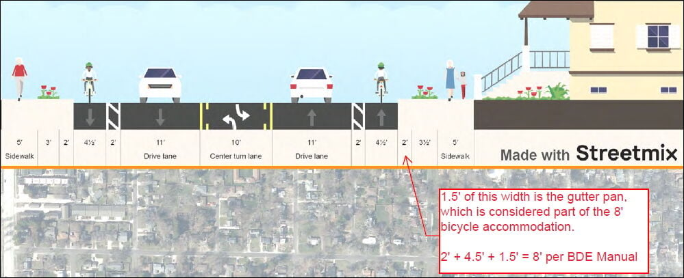
“A speaker at a recent Champaign City Council meeting said the recommended vehicle count for safety of in-town bike lanes is much lower than the current traffic count on Prospect Avenue. If that’s true, how do the city and IDOT reconcile that with the plans for bike lanes there?”
Many readers know that the Illinois Department of Transportation plans to reconfigure the portion of Champaign’s North Prospect Avenue between Bloomington Road and Springfield Avenue, which also serves as part of U.S. Route 150.
The planned “road diet” would reduce the current four traffic lanes to one northbound and one southbound lane with a turn lane in-between. North- and southbound bike lanes also are part of those plans.
Before seeking an answer to the Mailbag question, I went online and viewed the public-comment segment of the March 4 Champaign City Council meeting referenced in the question. The speaker identified herself as Laurie Reynolds of Champaign – “a very avid bike rider” who said she supports reducing Prospect Avenue from four lanes to three, but does not support either the introduction of bike lanes or removing the parkways to widen the street.
During public comment, Reynolds said a report on bicycling amenities by the National Association of City Transportation Officials “states clearly that unprotected bike lanes are appropriate for roads with fewer than 6,000 cars a day and speed limits of 25 mph or under. Prospect is about at 20,000 (vehicles) a day with a 35-mph speed limit. This is a dangerous idea, and I hope that the city will rethink it.”
I asked IDOT engineer Kensil Garnett whether IDOT’s planners used the NACTO standards the reader cited or a different set of guidelines, and I cc’d Champaign Planning and Development Director Bruce Knight on that inquiry.
Garnett said “since the City of Champaign’s Bicycle Vision Map indicated the ‘road diet’ and on-road bicycle lanes, (IDOT) completed a Bicycle Travel Assessment (BTA) for this section to analyze bicycle warrants.”
Knight said “in general, it is an IDOT project and they call the shots on it.
“It is correct that the city’s Bike Implementation Plan recommended the road diet and the bike lanes. It is also important to understand that IDOT did its own analysis and based on that confirmed the design would include the bike lanes. The three-lane cross-section was a necessary design decision because of the high number of rear-end and sideswipe accidents in that corridor. The only other solution would have been five lanes and there isn’t space for that with the existing homes along the corridor,” Knight said.
So … if IDOT doesn’t use the NACTO standards Reynolds mentioned in her comments to the city council, how did the agency arrive at its recommendations regarding the bike lanes?
Garnett said the BTA references a specific table in IDOT’s Bureau of Design and Environment (BDE) Manual. BDE Manual Chapter 17 has recommendations (for) bicycle accommodations on varying types of roadways with varying average daily traffic counts (ADTs), excluding interstate highways.
The BTA “indicates for an urban roadway with a posted speed of 35 mph and an ADT greater than 19,000, an 8-foot on-road bicycle lane is appropriate. This 8-foot lane shall also include the buffer as proposed with our project. The BDE Manual also notes that a Bicycle Level of Service (BLOS) of C or better be achieved in an urban setting; a BLOS of C is achieved with this project with the proposed improvements. This is an improvement from a BLOS of E when analyzing on-road bicycle lanes with current roadway conditions,” Garnett said.
“The BLOS takes into consideration 50% of the population that may not be comfortable in certain bike lanes or those that would usually prefer separated facilities such as an off-roadway shared-used path. The BLOS does not consider children as users of an on-road bicycle lane. With our proposed improvements achieving a BLOS of C, varying confidence levels of potential users are accommodated.”
“How will the planned reconfiguration of Prospect Avenue affect drainage in some older parts of Champaign when/if they widen the street by a total of 8 feet over the course of 1.3 miles?”
The second part of the question was “who foots the bill if it turns out the existing drainage infrastructure can’t handle the added/displaced water?”
Evaluation of storm-sewer capacity is a part of the engineering design of the project, said Bruce Knight, the City of Champaign’s planning and development director. “And while it is an area where the city may cost-share (if) improvement is needed, we aren’t aware of what has been determined at this time.” The Illinois Department of Transportation is the lead agency on the project that calls for widening the portion of Prospect Avenue, between Bloomington Road and Springfield Avenue, that also serves as U.S. Route 150.
“How many firearm shooting incidents were there, how many people were wounded by gunfire, and how many were killed by gunfire, in the municipalities of Rantoul, Champaign, Urbana, the UI campus and the surrounding Champaign County area during calendar year 2024?”
My thanks to crime-and-courts reporter Luke Taylor for the assist on this answer, which comes with a couple of caveats:
Each department describes and records data in its own way, Taylor said. “Some track ‘shooting incidents,’ while others are a little more broad, counting any report they got for ‘shots fired,’ so they may not necessarily have found evidence that shots were actually fired in every case.
“Even in the case of tracking ‘shooting incidents,’ Champaign police spokesperson Joe Lamberson, for one, emphasizes that it’s any scenario in which a gun was fired, whether anyone or anything was hit or not. Some also keep track of incidents with property damage.”
With those differences in mind, here are the 2024 numbers as reported by the agencies:
Champaign: 88 gun-violence incidents — five with a fatality, 31 with injuries and 47 with property damage.
Urbana: 45 shooting incidents — two with a fatality, 12 with injuries.
Rantoul: 104 shots-fired calls — two with a fatality, three with injuries, 11 with property damage.
UI Police Department: no shooting incidents reported.
Champaign County Sheriff’s Office: eight shots-fired calls — two with a fatality, one with injury, two with property damage.
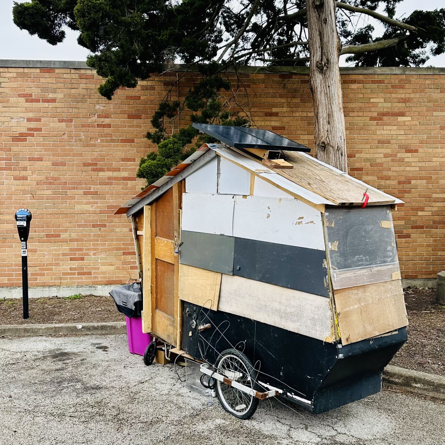
“What is this DIY project? It’s been parked behind the old post office in downtown Urbana for a few days. It even seems to have pop-up solar panels.”
It appears to be a portable shelter. Nick Hanson, with the city’s Community Development Services Department, said “this was an individual who took up temporary residency on (Lincoln Square Mall) property. My understanding is that they have now moved on.”
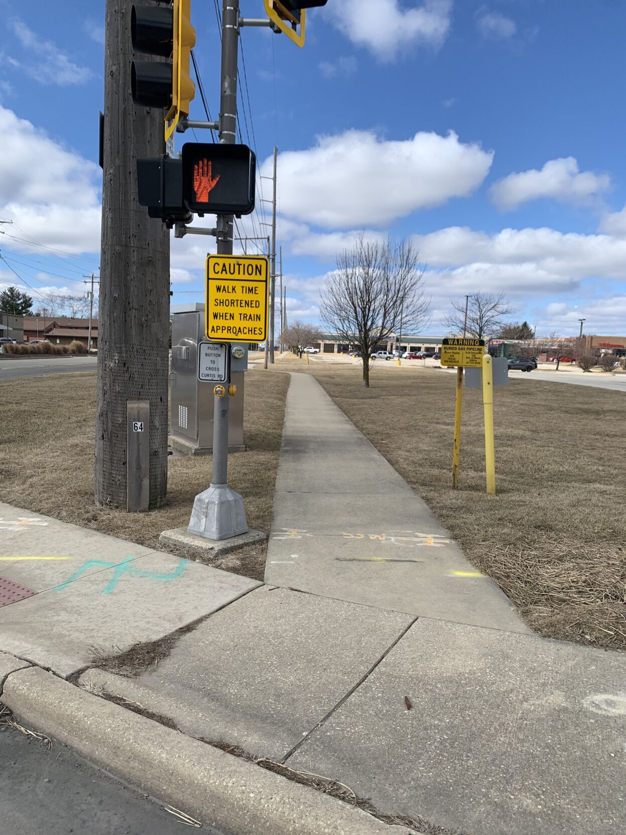
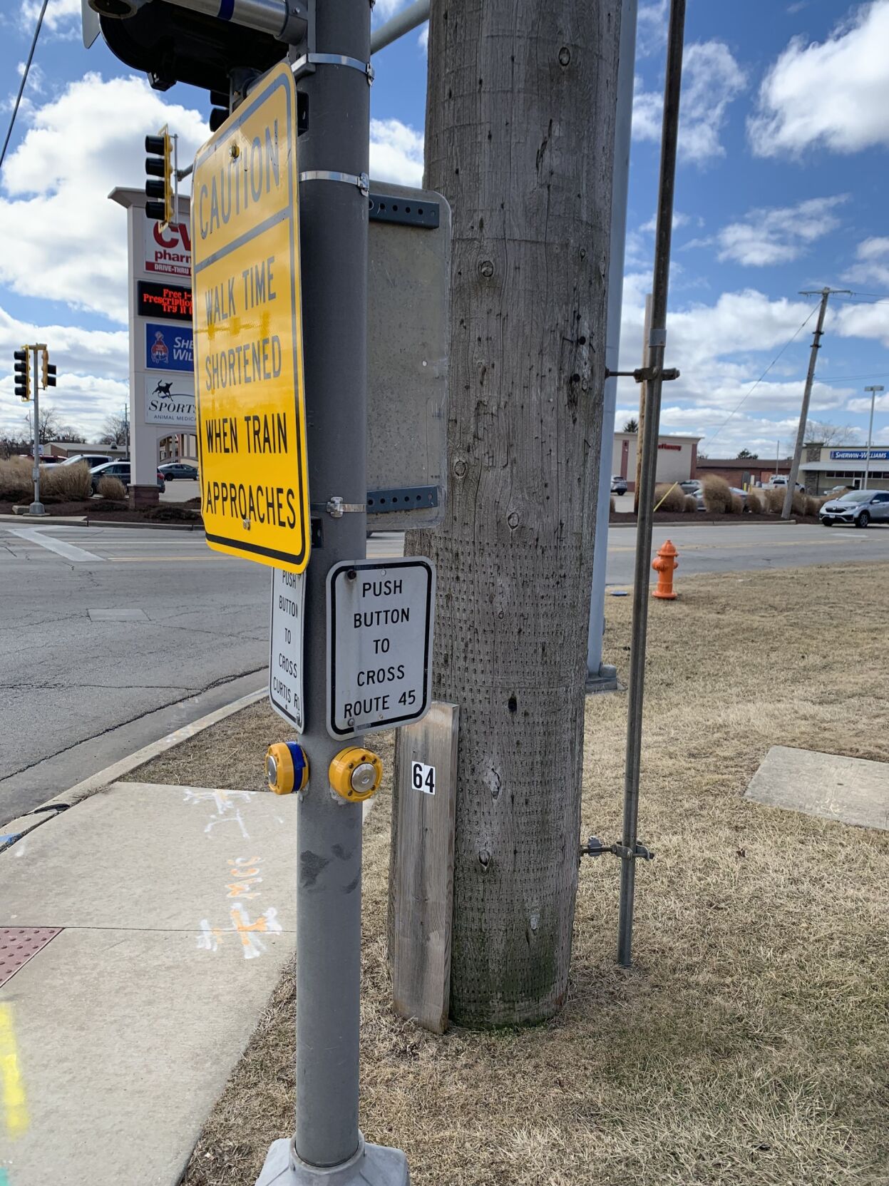
“This sign at the corner of Dunlap and Curtis in Savoy extends to the edge of the sidewalk, and pedestrians must look carefully to avoid hitting their head on its sharp edges. How can we get this addressed?”
The Illinois Department of Transportation has jurisdiction over the signs at this crossing, as Dunlap Avenue is part of U.S. 45.
The placement of the sign the reader mentioned is governed by the Federal Highway Administration (FHWA) Manual on Universal Traffic Control Devices (MUTCD), according to IDOT engineer Kensil Garnett. “Traffic signs placed in urban areas adjacent to pedestrian facilities shall be placed at 7 feet, minimum, to the bottom of the sign. Supplemental signs can be mounted lower but cannot extend more than 4 inches into the pedestrian facility.” (In this case, a sidewalk.)
“In this instance, the primary ‘sign’ is the traffic-signal head and the sign-in-question is considered supplemental. A field review was conducted and the sign-in-question was determined to be placed within the guidelines. While we would also like to change sign locations in some instances, congestion occurs often near intersections when there are many signs necessary, but limited space,” Garnett said.


